If you are reading this very post, I see that Leh-Ladakh has been on your mind since quite some time now. I have compiled a comprehensive itinerary to the dream land Ladakh - The Land of High Passes.
This was originally posted on my blog Little Detours 👇
I am writing this post from a perspective of a rider, who has completed this circuit successfully. The itinerary starts from Manali and ends at Jammu. So, you could probably follow the same itinerary even if you are riding the Delhi - Manali - Leh - Jammu - Delhi circuit. The day's numbers would be according to Manali - Leh - Jammu circuit. Follow along.
Things to know before the trip: If you want to know about how to prepare yourself and your bike for this trip, please visit my another post Preparing for Leh Ladakh trip.
Ladakh trip is a journey in the higher altitudes. Higher altitudes also means rarity of oxygen. The oxygen level is less than compared to the regular sea levels. When you are moving from a lower region to higher altitude region, the body has a difficult time adjusting to this drop in oxygen levels. If you do not take precautions, it can lead to Acute Mountain Sickness aka AMS or some other serious symptoms. One way to keep AMS at bay is to keep yourself hydrated even if you don't feel thirsty.
Day 1: Arrival at Manali
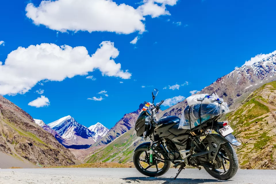
This is day when you arrive in Manali. You are probably driving from Delhi or planning to ride from Manali itself. Since this drive is gonna be long enough it advised to have a rest day at Manali if riding from Delhi. Get your bikes checked for issues if any. Make sure you double check everything about your bike here, unless you have hired a mechanic for your trip, who will come along. Most importantly, get your permits ready!
Day 2: Manali to Keylong via ATAL Tunnel
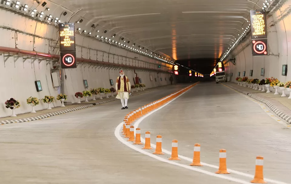
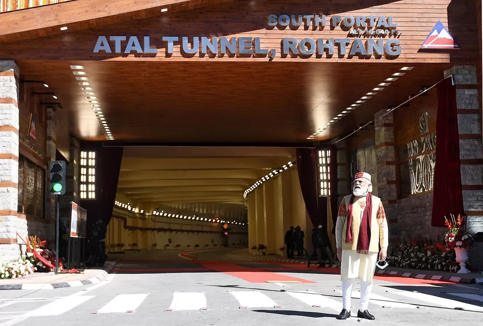
With the opening of the Atal tunnel (aka Rohtang Tunnel) along the Leh-Manali highway, the time and distance between Manali and Keylong has been significantly reduced. The road which was once dreaded among bikers and travelers alike has just become a journey of fewer than 2 hours compared to over 6 hours before.
Atal tunnel, at a length of 9.02 km, it is the longest tunnel above 10,000 feet in the world and is named after former Prime Minister of India, Atal Bihari Vajpayee. The South Portal of the tunnel towards the Manali end is just 24 km away from Manali. It takes about 15 to 20 minutes to reach the North Portal of the tunnel and Keylong which just 37 km from this end, can be reached in just 60 minutes.
Although riding through the Atal tunnel at such a height is a feeling in itself, adventure seekers will miss out on the sceneries and the tough riding conditions but will save a lot of time. If you are taking the tunnel, you can even cover Day 3's journey today. If you don't want to take the tunnel, you can skip through to the next section
Should I take the Atal Tunnel?
1. If you are traveling with kids and aged people over 50-60, it's advised to take the tunnel, as the altitude gain will be minimal today.
2. If you are tight on the budget or number of days available, you can take the tunnel and save some time and a lot of fuel.
3. If you are an adventure rider, who wants to see what it takes to ride in the mountains, you shouldn't take the tunnel. Refer to the next section.
Start time: 8 AM. The earlier the better.
Altitude gain: 6,726 ft to 10,100ft
Highest altitude reached: 10,171 ft at Atal Tunnel
Prone to AMS? No. Drink lots of water though.
Road conditions: At the time of writing, the roads are in pretty good condition. The Atal Tunnel is just amazing!
Fuel points: Fill up your tanks at Manali and make sure you carry at least one empty can of 5 liters minimum. The next fuel point is at Tandi (just before Keylong), which is the last fuel point until next 365 kms. Be sure to fill up your tank to the brim, and fill up the extra cans.
Accommodation at Keylong: There are many tents/ rooms available at Keylong.
If you are not taking the road via the Atal tunnel, you my friend are up for a challenge!
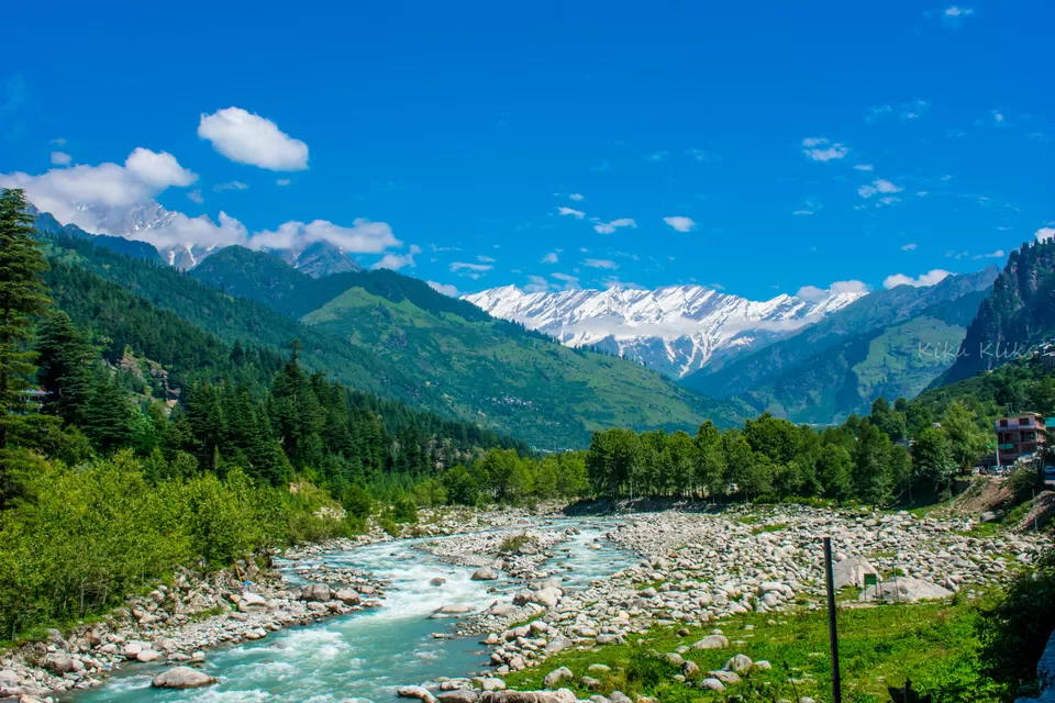
This is the first day of your ride. You would want to start early and ride rather slow today. This is the day you will sight the snow-capped mountains for the first time, while slowly gaining altitude. You will drive through the dense forests for the first part of your ride.
Start time: 8 AM. The earlier the better.
Altitude gain: 6,726 ft to 10,100ft
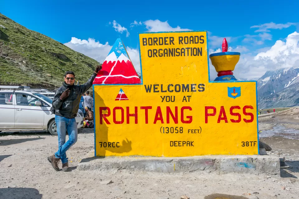
Highest altitude reached: 13,050 ft
Prone to AMS? Yes! The altitude gain is very rapid. It is advisable to take a doctor advised medicine like Diamox.
Road conditions: At the time of writing, the roads are pretty good till Rohtang La Pass. The road from Rohtang Pass to Koksar (50 kms before Keylong) is worse.
Fuel points: Fill up your tanks at Manali and make sure you carry at least one empty can of 5 liters minimum. The next fuel point is at Tandi (just before Keylong), which is the last fuel point until next 365 kms. Be sure to fill up your tank to the brim, and fill up the extra cans.
Accommodation at Keylong: There are many tents/ rooms available at Keylong.
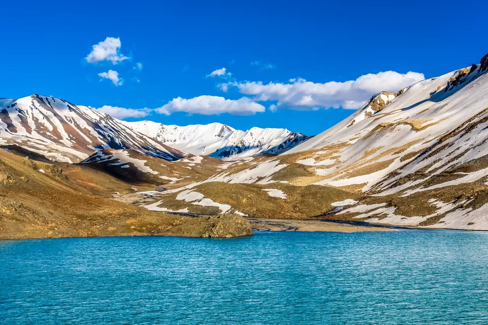
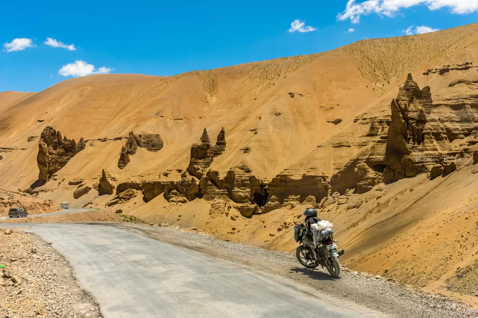
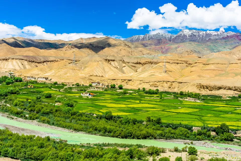
This is the most happening day of the trip. You would find everything from simple streams running across the roads to some deadly ones, to the turquoise blue waters of some of the most beautiful lakes like Deepak Tal and Suraj Tal.
Start time: 8 AM. The earlier the better.
Altitude gain: 10,100 ft to 14,070 ft
Highest altitude reached: 16,040 ft
Prone to AMS? Yes, very much. Consider taking a doctor-prescribed tablet (ex Diamox) before starting the journey and you are good to go. You can have another one after a gap of 4-6 hours as advised by your physician. As said before, consult a doctor about the usage of Diamox
Road conditions: Except for a few kms near Keylong, and near the streams, the roads are in good condition. Last few kms to Sarchu are pathetic. It's all mud and gravel.
Fuel points: No fuel points today!
Accommodation at Sarchu: There are many tents/camps available at Sarchu. You may book online or try to find one on the fly.
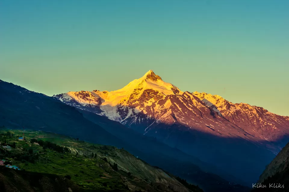
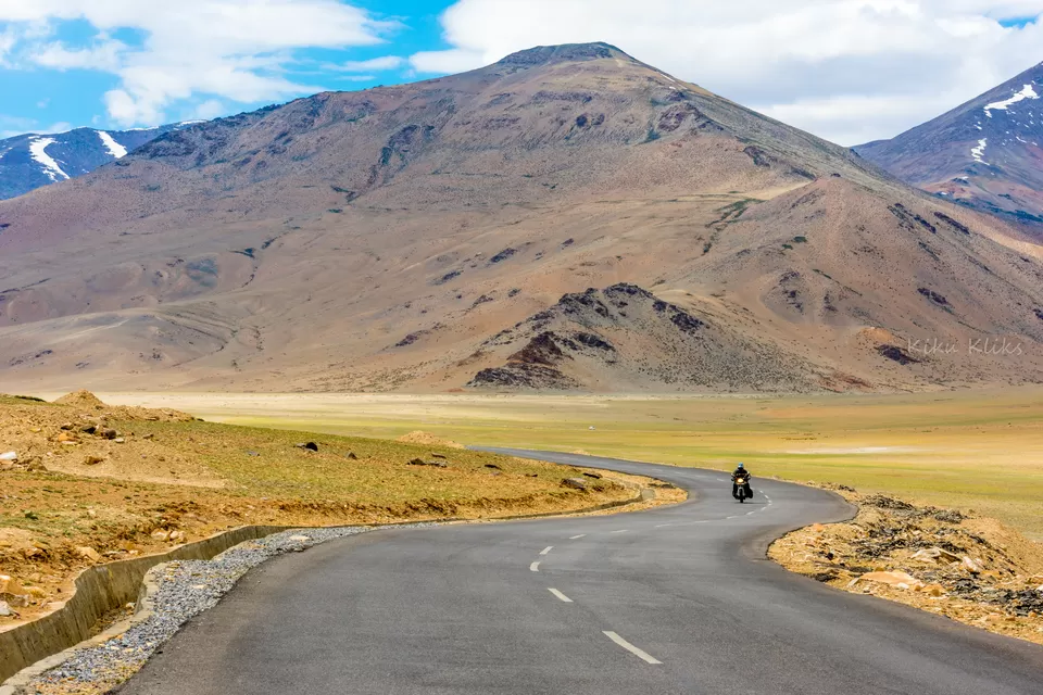
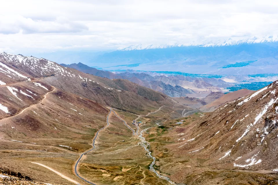
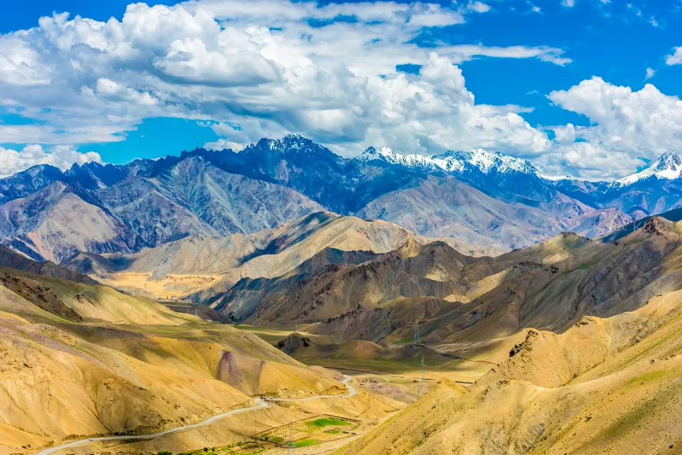
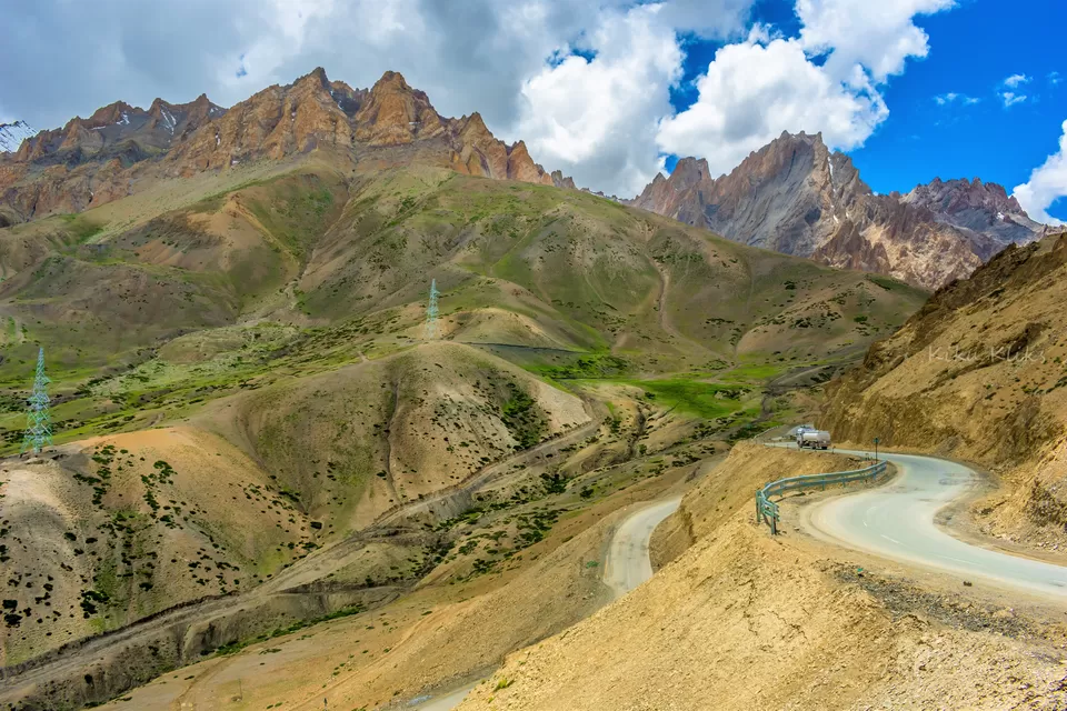
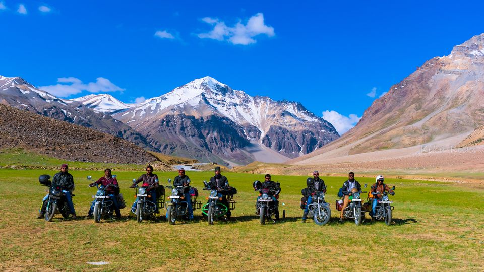
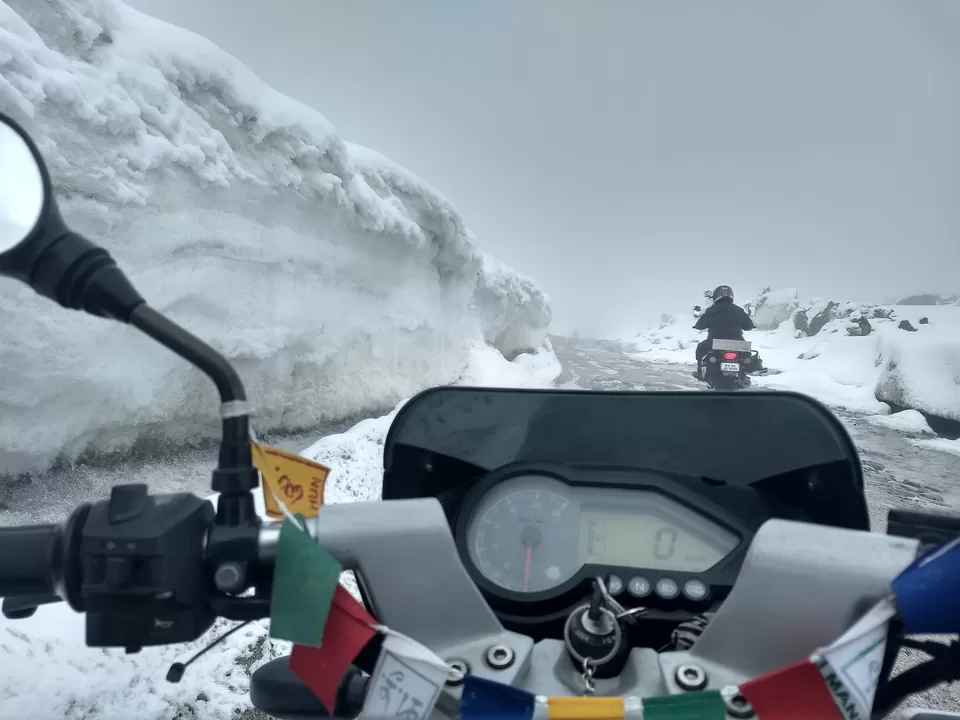
The Day of High Passes. This is the longest you will ride on a single day during this journey. This ride is difficult. Although there is an overall drop in altitude from Sarchu to Leh, you would pass through some of the highest passes along ranging from 15,500 ft (at Nakeela Pass) to 17,500 ft (Taglangla Pass). The Gata loops and the Moore plains along the highway from Pang to Leh is the highlight for today.
Start time: 7 AM. Anything later than 8 AM is trouble.
Altitude drop: 14,070 ft to 11,480 ft
Highest altitude reached: 17,480 ft at Taglang La Pass
Prone to AMS? Yes! Strongly advised to take a doctor prescribed tablet (ex, Diamox)
Road conditions: The roads are decent till Nakeela Pass just after Gata Loops. From Nakeela Pass to Pang, the roads are pathetic. Do not take shortcuts to avoid the hairpins. You will find the best roads from Pang to Leh.
Fuel points: No fuel points until Leh.
Accommodation at Leh: Although there are plenty of Guesthouse and hotels in Leh, it's recommended to book early and find a good guest house which is near to the highway.
Day 5: Rest Day at Leh
Today is the rest day. After riding for 3 days non stop and covering close to 500km, both you and your bike needs rest. You would need to acclimatize for at least a day before you continue the onward journey.
You could as well use this day to get your permits ready and get your bike checked for any issues. If you find any issues, now is the time to fix it. You can explore the Market in the evening, and enjoy the lazy strolls around the streets of Leh.
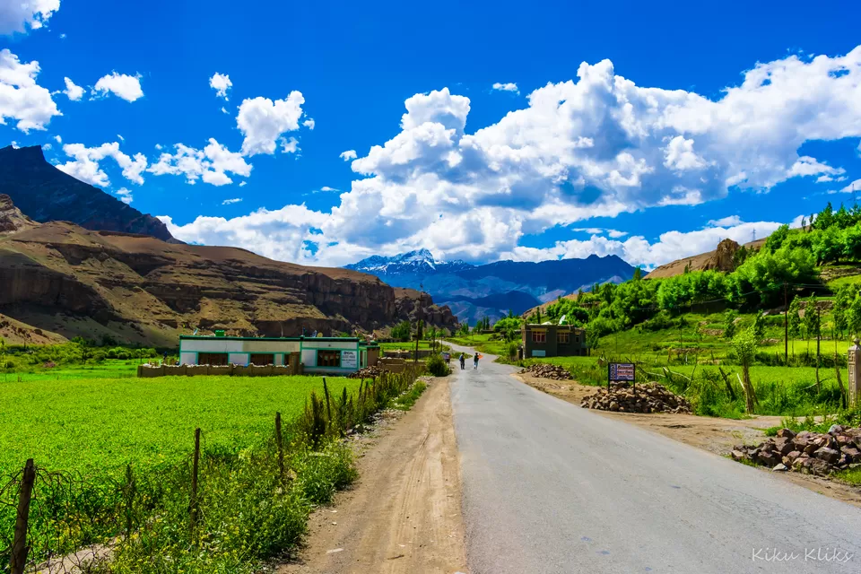
Day 6: Leh - Hall of Fame - Magnetic Hills - Sangam (Confluence of Indus and Zanskar) - Thikse Monastery - Stakna Monastery - Leh
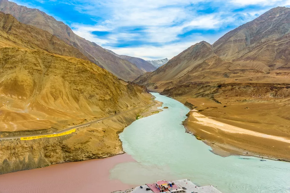
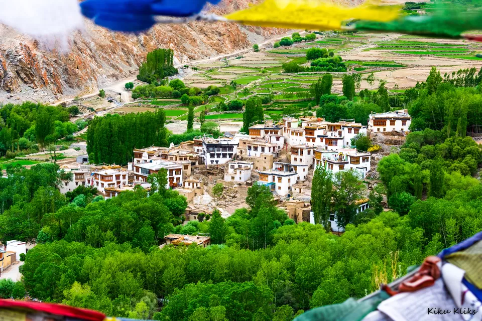
Enjoy a lazy ride in the city of Leh and visit some of the nearby monasteries and other places. You would witness some of the calm and serene regions of Ladakh when you visit these monasteries. If you are a shutterbug like me, ask no more! The mesmerizing calmness in the air makes you forget everything for a while.
Start time: 9-10 AM
Distance covered: ~ 60 - 70 kms
Altitude avg: 11,500 ft. Not much change in altitude today.
Fuel points: Easily available in the city. One of them is present at the junction of Srinagar and Manali highway.
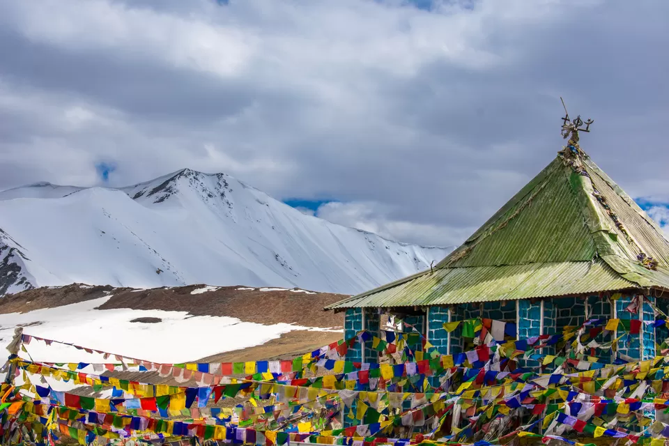
Khardung La was once deemed the Highest Motorable Road at 18,379 ft. There were lot of debates about the incorrect altitude measurement. Many reports proved that the altitude was actually 17,582 ft. However, with the new road to Umling La Pass at 19,300 ft built by Border Roads Organisation (BRO) in November 2017, has put a rest to all the discussions about whether Khardung La was really the highest motorable road.
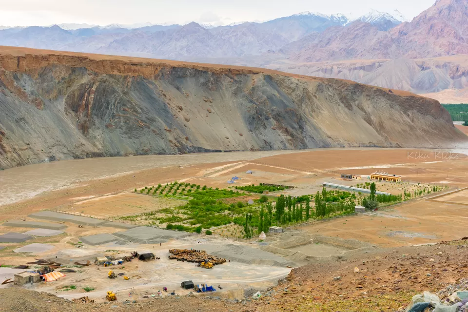
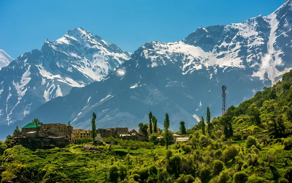
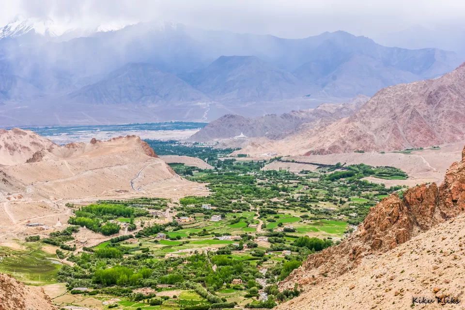
Nubra Valley is a beautiful valley along the Nubra river, which offers a picturesque view of the sand dunes at the valley.
Start time: 7 - 8 AM
Altitude drop: 11,480 ft to 10,000 ft
Highest altitude reached: 17,582 ft at Khardung La Pass
Prone to AMS? Yes! Consider taking a tablet as prescribed by your doctor. Most people take diamox.
Road conditions: The roads are decent till South Pullu checkpoint. The last 10 kms on either side of Khardung La pass will put and your bike to a treacherous test! Be sure to maintain balance, and ride at your own pace.
Fuel points: Only one fuel point near Diskit. Don't forget to fill up, and carry extra fuel!
Accommodation at Nubra: You could find tent houses easily at Nubra.
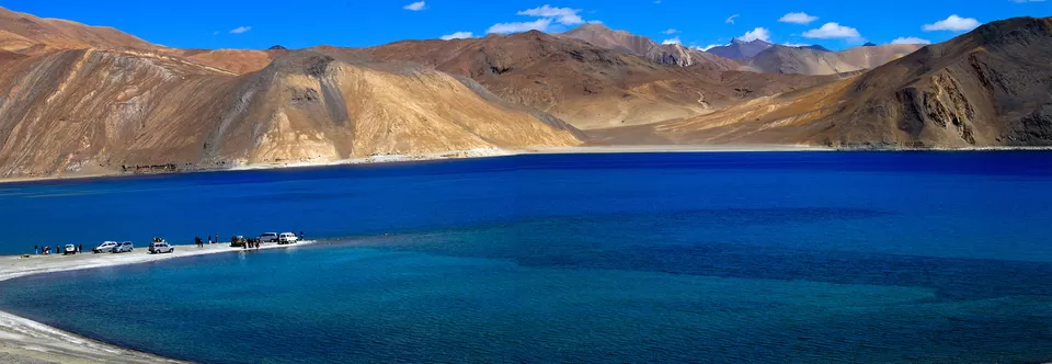
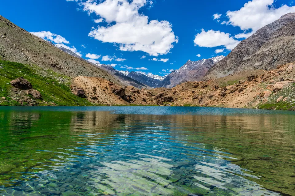
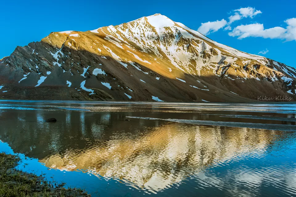
Pangong Tso - Tso meaning Lake, has gained a lot of popularity after the ending sequence of the Bollywood movie 3 Idiots. Since then, the place has seen more travelers and tourists than ever. Nonetheless, the place is a must visit if you are in Leh!
The blue turquoise waters of the lake against the mighty mountains in the backdrop is a sight you would cherish forever!
Start time: 7 AM
Altitude gain: 10,00 ft to 13,940 ft
Highest altitude reached: 13,940 ft at Pangong Lake
Prone to AMS? Not really!! But don't take chances. Drink lots of water
Road conditions: The road conditions have improved over the last couple of years. The road which was once a dreaded one has got a tarring now.
Fuel points: No fuel points until Leh via Pangong. Carry extra fuel. Diskit has the last fuel point.
Accommodation at Pangong Tso: Since this place receives a lot of visitors in any season, its best to book a hotel/tent in advance.
The next day, go out and click some pictures. If you are photography buff, then you better start clicking early. Leaving Pangong lake early is a good idea, especially if you are visiting during the peak time.
Start time: Not later than 9AM
Altitude gain: 13,940 ft to 11,480 ft
Highest altitude reached: 17,590 ft at Chang La Pass
Prone to AMS? By now, you should be acclimatized already. In any case, it's better to take precautions
Road conditions: The road from Pangong is good for about 10-15 kms, after which the condition deteriorates. The road near Chang La pass is pathetic, and there will be streams near Chang La. Again, after Chang La, the roads are better near Sakti village.
Fuel points: No fuel points until Leh
Accommodation at Leh: There are plenty of hotels and homestays at Leh. If you do not want to spend any time looking for a stay, book online.
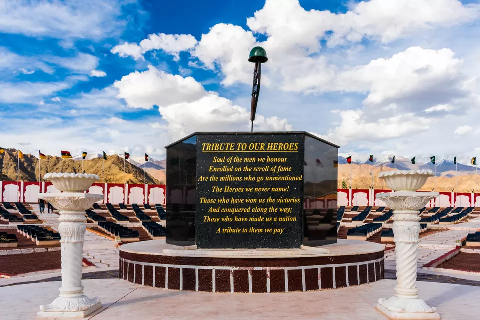
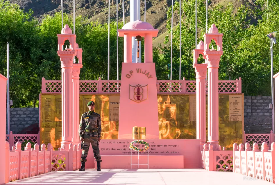
Today you would witness the best views of this entire trip! Be prepared to be blown away by the picturesque landscapes and views! Also, the War Memorial at Dras simply cannot be missed.
Start time: 7 AM
Altitude drop: 11,480 ft ft to 10,830 ft
Prone to AMS? No
Road conditions: The road from Leh is in absolutely top condition, except for a couple of rough patches near Kargil
Fuel points: Fuel point are available in Leh city, just the city limits of Leh on the way to Kargil. The fuel points are also available at Kargil.
Accommodation at Kargil/Dras: There are a decent amount of hotels and homestays at Kargil/Dras. If you do not want to spend any time looking for a stay, book online.
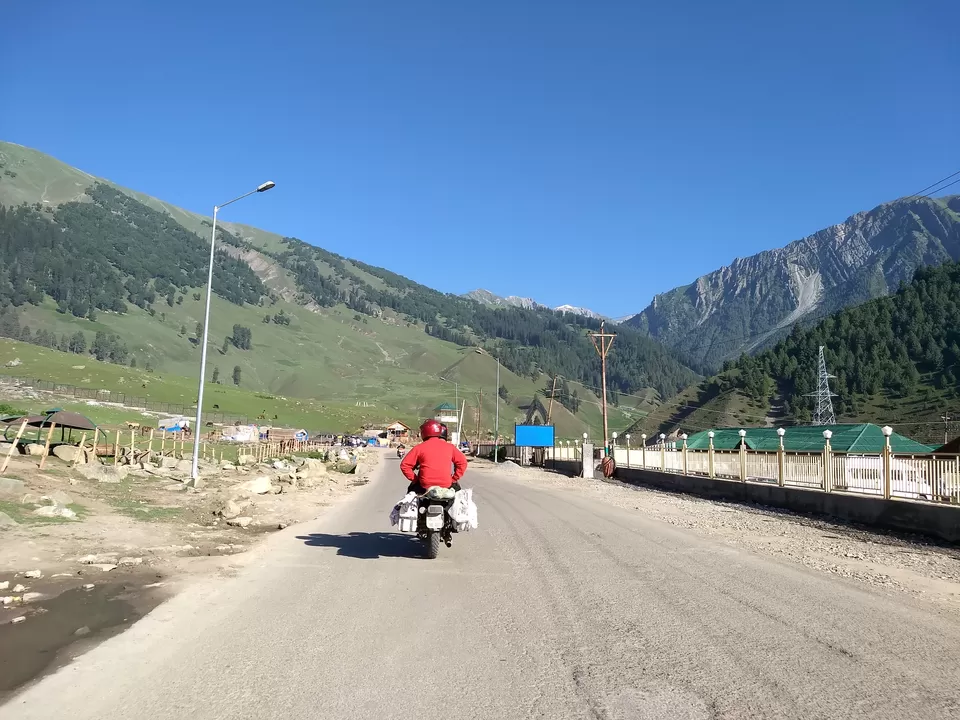
Get ready to be blown away by the beauty that is called Jannat meaning Heaven, another name for Kashmir! Beautiful fields, valleys, and mountains! Also, today you will cross the dreaded Zojila Pass. Since you reach Srinagar in the afternoon, you can book a boat house and enjoy a beautiful evening on the boats at Dal Lake.
Start time: 8 AM
Altitude drop: 10,830 ft to 5300 ft
Highest altitude reached: 11,650 ft at Zojila Pass
Prone to AMS? No
Road conditions: The road from Dras to the start of Zojila Pass is pathetic, (unless its repaired recently). The road condition improves only after descending a bit from the Zojila Pass
Fuel points: Fuel point are available just a few kilometers ride from Sonamarg on the way to Srinagar. Fuel points also available at Srinagar.
Accommodation: Stay at a boathouse near Dal Lake. Enjoy the beautiful sunset vibes at Dal Lake!
12. Srinagar - Jammu (267 kms - 9 hours)
The last day of the trip is here! Based on your further plans, the ride may continue. Today can be a tiring day if you don't start on time. You would witness some winding, seemingly endless roads around the mountains. Also, its time to experience few of the longest tunnels in India!
Start time: 5 AM (To beat traffic, and also to avoid night ride)
Road conditions: The road is excellent, only for a few rough patches.
Fuel points: Apart from Srinagar and Jammu, you can get fuel near Udhampur. Better to have enough fuel filled at Srinagar.
Pro Tip: Skip Patnitop, and take the Chenani Nashri Tunnel towards Jammu, which saves a couple of hours and lot of fuel.
Accommodation: Plenty of hotels available at Jammu. Book on the fly based on your plan.
Follow me on my Instagram handle @little_detours for more stories.
Also witness some amazing travel stories and vlogs on my Youtube Channel Little Detours.